High Water Mark
The good side to all those mega-storms? More data for experts studying the impacts of sea-level rise.
China Camp is fortunate to be a target study area for researchers from the San Francisco Bay National Estuarine Research Reserve (SF Bay NERR). Here, the team’s Research Technician Jeremiah Ets-Hokin and Research Director Matt Ferner, share some of the latest findings on the impacts of sea-level rise on China Camp’s ecosystems, as well as on the park’s single access route, North San Pedro Road.
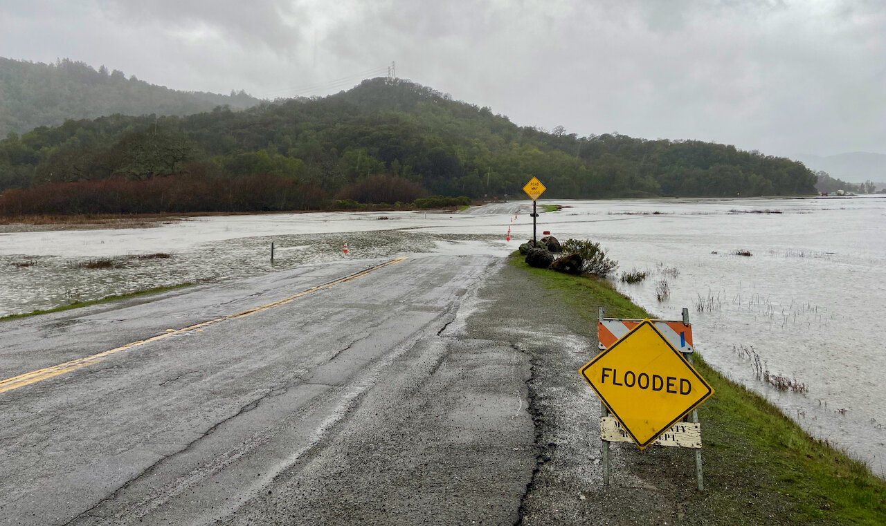
As powerful storms ripped through the Bay Area this winter, rising water was on everyone’s mind. On January 5, 2023, when a mega-storm coincided with seasonally high tides, flooding at China Camp was inevitable. Tidal wetlands virtually disappeared under feet of water, as did sections of North San Pedro Road, the park’s only paved access road. Water flooded the road’s lowest point at Back Ranch Meadows for almost five hours, blocking access through the park in both directions and creating a safety hazard for adjacent communities. For a time, parts of the park were inaccessible.
A flooded roadway is something all of us can relate to, but intense and frequent flooding can also impact an ecosystem. Here, China Camp is playing an important role, helping researchers study those often-subtle impacts, and what they mean to the health of these ecosystems not just at the park, but in all coastal ecosystems being affected by sea-level rise.
What makes China Camp so important and useful? The park protects some of the Bay Area’s healthiest tidal wetlands—remnants of a massive ecosystem that once ringed San Francisco Bay. Normally, salt marshes like the ones at China Camp help mitigate the effects of sea-level rise. But there is likely a tipping point, beyond which wetlands can’t survive due to excessive flooding.
Fortunately, for the past few years, the San Francisco Bay NERR team has been using various techniques and technologies to monitor water levels and impacts on the marsh. Along North San Pedro Road at Back Ranch Meadows and Miwok Meadows, automated data-loggers record water depth every six minutes. Every couple of months, a NERR technician heads out to the monitoring locations to download data.
Getting measurements within millimeters
Another important step in tracking sea-level rise requires creating stable “vertical points of reference”—specific, fixed locations where researchers can reliably return to take precise measurements. These locations help researchers track fluctuating water levels, how changing levels relate to marsh hydrology, and how they impact the surface and integrity of North San Pedro Road.
To establish these fixed locations, known as benchmarks, professional land surveyors drove metal rods deep into the ground along North San Pedro Road. Once the rods were in place, NERR staff could use Global Positioning System (GPS) antennas and digital leveling—basically the same technology used by land surveyors—to measure water levels at precisely the same locations every time. This information is then combined with details from the data-loggers, providing measurements to within just a few millimeters of actual water levels.
This level of precision allows NERR staff to reliably track changing water levels. That in turn helps all stakeholders make informed, collaborative decisions on how to protect China Camp’s tidal wetlands, and to preserve and allow safe access through the park via North San Pedro Road. What’s more, findings and decisions made at China Camp can help inform future efforts at other areas similarly impacted by coastal flooding and sea-level rise.—By Jeremiah Ets-Hokin and Matt Ferner
For more on the challenges of sea-level rise at China Camp and proposed solutions regarding North San Pedro Road, see this article from FOCC’s newsletter archives. For more on the impacts of long-term salt-marsh flooding, see this article.