Miwok Meadows Nature Walk
By Marco Burger, Sheila Coll, and Harriot Manley
WELCOME TO MIWOK MEADOWS
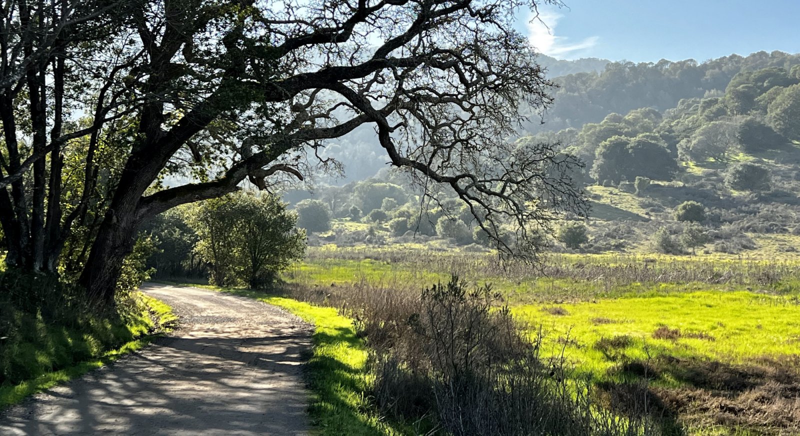
With grasses and marsh plants waving in the wind, encircled by tall oaks and dark green bay trees, Miwok Meadows stands out as a beautiful and peaceful place in China Camp State Park.
This eight-stop, roughly 1-mile loop tour begins at the entrance gate to Miwok Meadows, along N. San Pedro Rd. It follows the dirt fire road section of Shoreline Trail through the Miwok Meadows picnic area, then continues northeast around the meadow on Shoreline Trail, past Bullet Hill, and back to N. San Pedro Rd. The hike finishes with a short walk along N. San Pedro back to your car.
This self-guided tour will help you explore the natural wonders of this important meadow. We’ll show you where to look for animals, where they live and what they eat. We’ll also point out some of the meadow’s most interesting plants and why they’re special.
Know before you go
Safety Reminders
- Leave pets at home.
- Fill your water bottles before you start your walk; there is no drinking water on the trail.
- Remove all valuables from your car. Be sure to lock all doors and close windows.
- Stay on the trail to avoid damaging habitat, and to reduce your risk of getting poison oak and ticks. Avoid ticks by wearing long sleeves and pants. Tuck pant bottoms inside socks. After your hike, check yourself and your companions closely for ticks. Wash any exposed skin with Technu or strong soap to reduce your risk of poison oak.
- Don’t disturb wildlife.
- Share the trail—be alert for mountain bikers, as well as runners.

STATION 1:
WHO MADE THAT HOUSE OF STICKS?
Answer: Dusky-footed woodrat
Once you go through the entrance gate, look at the tree on the right. Do you see that big pile of sticks in the tree, about three feet off the ground? It’s the home of a dusky-footed woodrat. These native rodents are known for building stick nests that reach up to five feet tall and eight feet wide. Woodrats like cool, sheltered places, so they often build their houses against the trunk of a shady tree trunk or log, or inside dense shrubs. Female woodrats build large nests to rear their young. When the mother dies, her daughters stay in the nest to raise their young. Males tend to build smaller nests, sometimes perched high in trees.
Just a pile of sticks? Nope! If you could crawl inside you’d discover that woodrats create rooms for separate uses, like food storage, sleeping, and going to the bathroom. You might also discover shiny items, like bottle caps and coins. That’s because woodrats, nicknamed packrats, are known for collecting shiny objects. So if you lose your keys at China Camp, they might end up in a woodrat’s nest.
Woodrats make their own bug repellent. Dusky-footed woodrats are known to line their nests with leaves of the California bay laurel, since the leaves’ oils naturally repel insects.
Watch out! At China Camp, woodrats have to be on the lookout for all kinds of predators—owls, coyotes, bobcats, hawks, snakes, and even skunks. Woodrats are generally nocturnal, and tend to be extremely shy and skittish. You would be too if you had that many predators interested in eating you!
► From the woodrat nest, follow the dirt fire road (Shoreline Trail) south for about 10 minutes until you reach the Miwok Meadows picnic area (picnic tables, portable toilets; no running water).
(Woodrat image: Peterson B. Moose/USFWS, Nest image: Harriot Manley)
STATION 2:
SALTY OR FRESH — WHICH KIND OF MARSH IS IT?
Answer: It’s both!
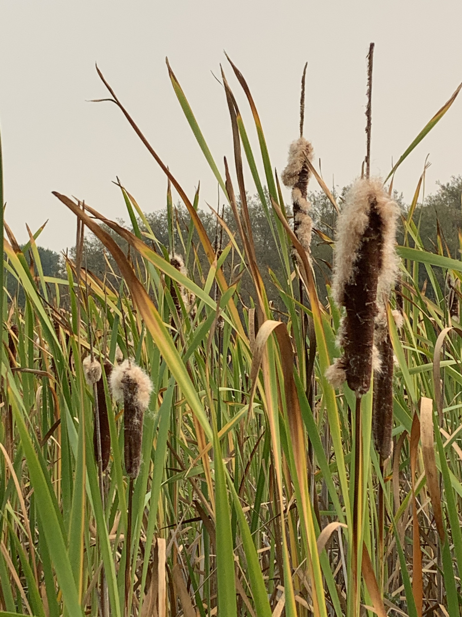
Look out across the boggy marshland in front of you. See how the plants change? To the west, towards the hills framing China Camp, look for the tall spires of cattails and lots of leafy shrubs. Now look east towards the bay. Notice how the plants change, with fewer and eventually no cattails, and ground-hugging pickleweed and short salt grasses covering the flatland. This is what’s called a transition zone. Here, the freshwater marsh, fed by rain, runoff, and springs, shifts to tidal wetlands, which are laced with twisting canals and regularly inundated by salty bay water.
Just add salt. As saltiness, or salinity, changes, so do the plants, since some plants have adapted to tolerate saltier water.
Who lives here? This diverse mix of plants surrounding you supports a wide range of animals—fish and shellfish in the tidal canals, birds nesting and roosting in the shrubs and trees, and mammals following trails through the grasses. For thousands of years, all this life attracted humans too. Indigenous Coast Miwok called this area home for thousands of years before European explorers arrived in the 1500s, drastically changing the Miwok’s lives.
We will talk more about the Miwok people later in our walk.
(Cattails image: Harriot Manley)
STATION 3:
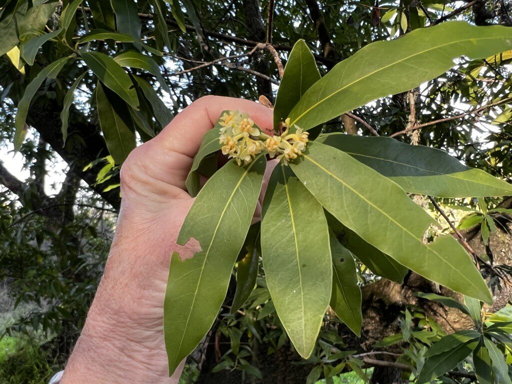
WHICH TREE LEAF ADDS GREAT FLAVOR TO SOUPS AND STEWS?
When you leave the picnic area, cross the first bridge and look down on the ground to your right. See any pale green or yellow leaves shaped like cigars? Pick one up and squish it between your fingers. Now sniff. If it’s a California bay laurel leaf, you’ll smell a strong, spicy scent.
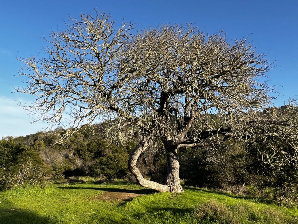
Look up—can you figure out which ones are the bay trees by the shape of the leaves? Look for twisting limbs, rough bark, and those cigar-shape leaves in shades of green.
You can cook with bay leaves. Bay seasoning is a popular addition to sauces, soups, and stews. Store-bought bay leaves are collected from Mediterranean bay trees, which aren’t as pungent as our California bay laurels. But you can cook with California bay—just reduce the amount you use. (If a recipe calls for a whole leaf, just add half a leaf.) Try to pick young, pale green leaves too—they’re not as pungent.
(California bay laurel image: Harriot Manley)
STATION 4:
WHO MADE ALL THOSE HOLES?
Answer: Red-breasted sapsucker
Just before you get to the second bridge after the picnic area, look right and up the oak tree trunk near the trail. See those horizontal rows of holes? They’re the work of a red-breasted sapsucker, medium-size woodpecker that lives in the western forests of North America.
Stick out your tongue like a sapsucker. While we humans have fleshy red tongues to help us taste and swallow our food, a sapsucker’s long tongue is lined with a stiff, hairlike fringe which helps the bird eat. First, the sapsucker uses its pointed beak to drill rows of holes into the tree, then the sapsucker departs. Soon, the holes begin to ooze sap. Back comes the sapsucker to lap up the sap with the help of its fringed tongue.
(Red-breasted sapsucker holes image: Harriot Manley)
JUST FOR FUN!
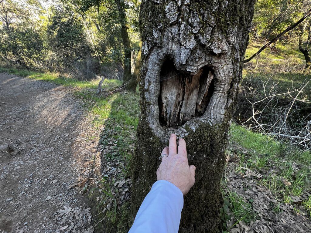
CAN YOU FIND THE “HEART TREE”?
Once you pass the second bridge (Bridge #5), look to the right to find a California live oak tree with a large, heart-shape scar in its trunk. This scar probably formed when a large branch broke off, which happens quite often to live oaks. These scars can sometimes become homes to bats, rodents, and cavity-dwelling birds.
(“Heart tree” image: Harriot Manley)
STATION 5:
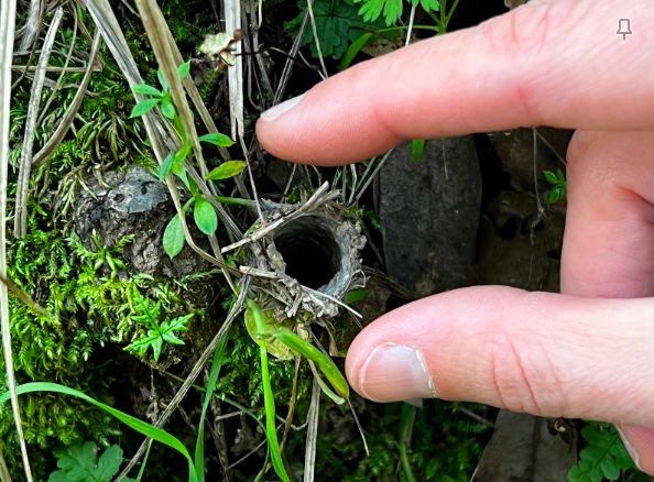
WHO’S INSIDE THAT TINY TUBE?
Answer: Turret spider
From the sapsucker tree, turn around and focus on the low bank. Now try to spy what looks like a tiny hole in the ground. Look a little closer to discover a short tube, spun out of spider web and camouflaged by bits of dirt and plant debris, poking up from the ground. You’ve discovered the home of a turret spider!
Turret spiders are found only in California’s Coast Range and Sierra Foothills. Within their range, they are limited to moist woodlands, often on north-facing slopes, and near shady streams and thickets.
Turret spiders can be tough to spot. First, they’re little. Full-grown, turret spiders are less than an inch long. And, they’re reclusive, generally hiding deep in their underground burrows during the day.
Search for turret spider doorways instead. The spiders’ turret-shape doorways give these arachnids their name. As you continue your walk, look along the banks on the north-facing sides of the trail. See how many turret spider homes you can spy.
Come nightfall, they ambush their prey. Once the sun sets, turret spiders climb from their burrows and poise just inside their turrets. There they’ll wait, tuning in to vibrations that signal a passing ant, millipede, beetle, or other creepy crawlie that could provide a meal. Then, the spiders pounce, lunging part way out of their turrets to seize their prey.
(Turret spider nest image: Harriot Manley)
STATION 6:
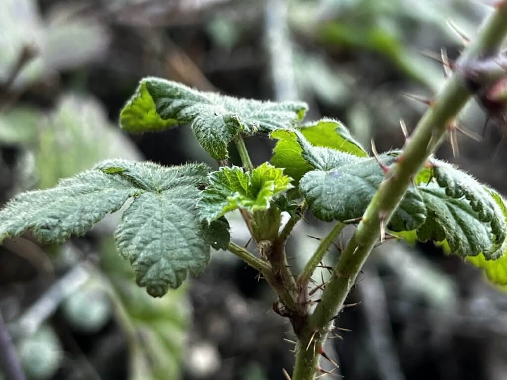
WHAT DOES “IF IT’S THREE, LET IT BE” MEAN?
Answer: Hand’s off blackberries and poison oak!
Ever heard the saying, “If it’s three, let it be”? All over China Camp, that’s a very good idea. Two types of plants with three leaves can make life pretty unpleasant. First, blackberry. Both native and nonnative (invasive) blackberries thrive in the park, and both have plenty of cloth- and skin-grabbing thorns, though the thorns of native blackberries tend to be smaller. That doesn’t make them hurt any less though!
The other three-leafed plant to watch out for: poison oak. It’s shiny leaves pack a nasty punch: rub against them and you can pick up natural oils that can cause an itchy, oozing rash. Volunteer trail crews at China Camp try to keep these two plants well trimmed along our trails, so you’re generally okay if you don’t wander from the tended paths.
(Native blackberry image: Harriot Manley)
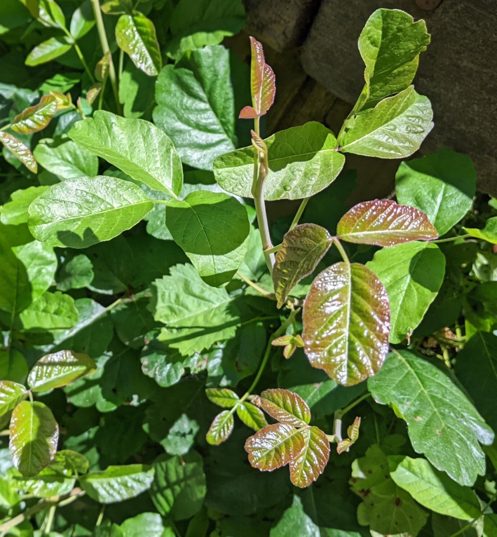
Poision Oak (Stop X): Sheila Coll/FOCC
STATION 7:
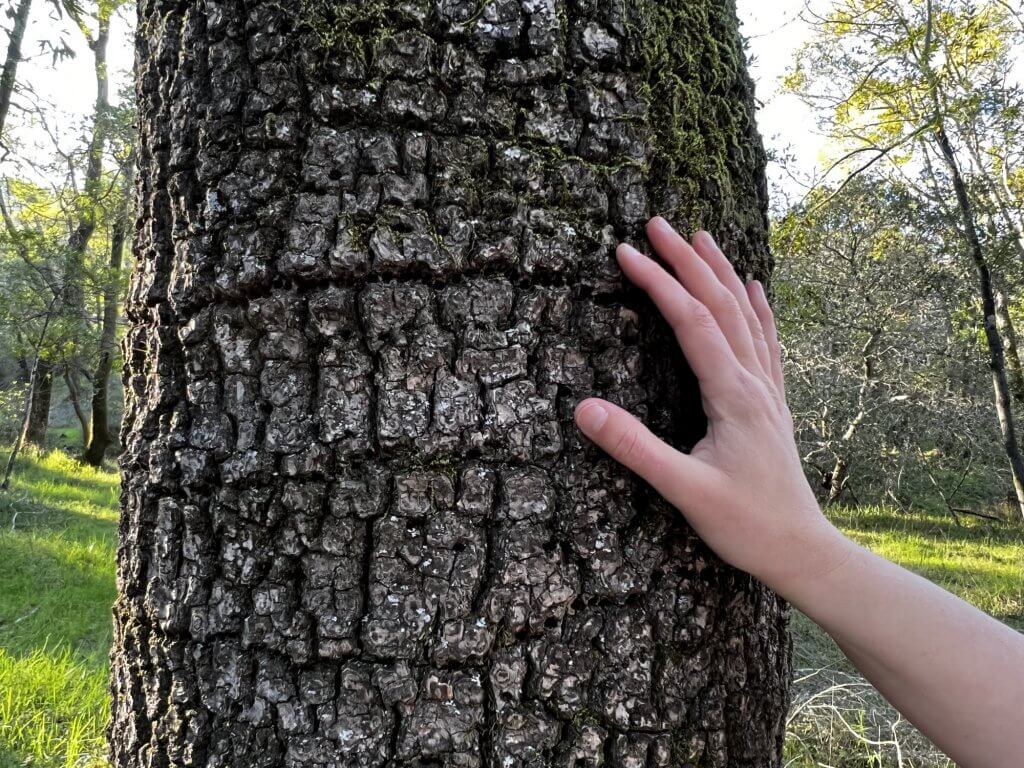
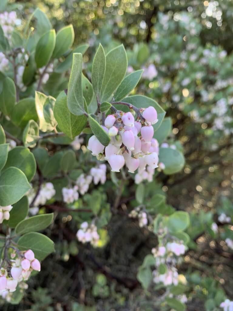
WHICH SHRUB HAS PEELING BARK?
Answer: Manzanita
Several types of these evergreen shrubs thrive at China Camp, even in areas with poor soil and little water. Look for bushes or small trees with narrow, twisting branches and smooth orange or red bark, often speckled with bits of peeling bark.
Scientists believe that this peeling could be a natural way for the shrub to rid itself of potentially damaging organisms, like lichen and moss, which attach themselves to the plant and drain it of nutrients.
(Manzanita in bloom image: Harriot Manley)
STATION 8:
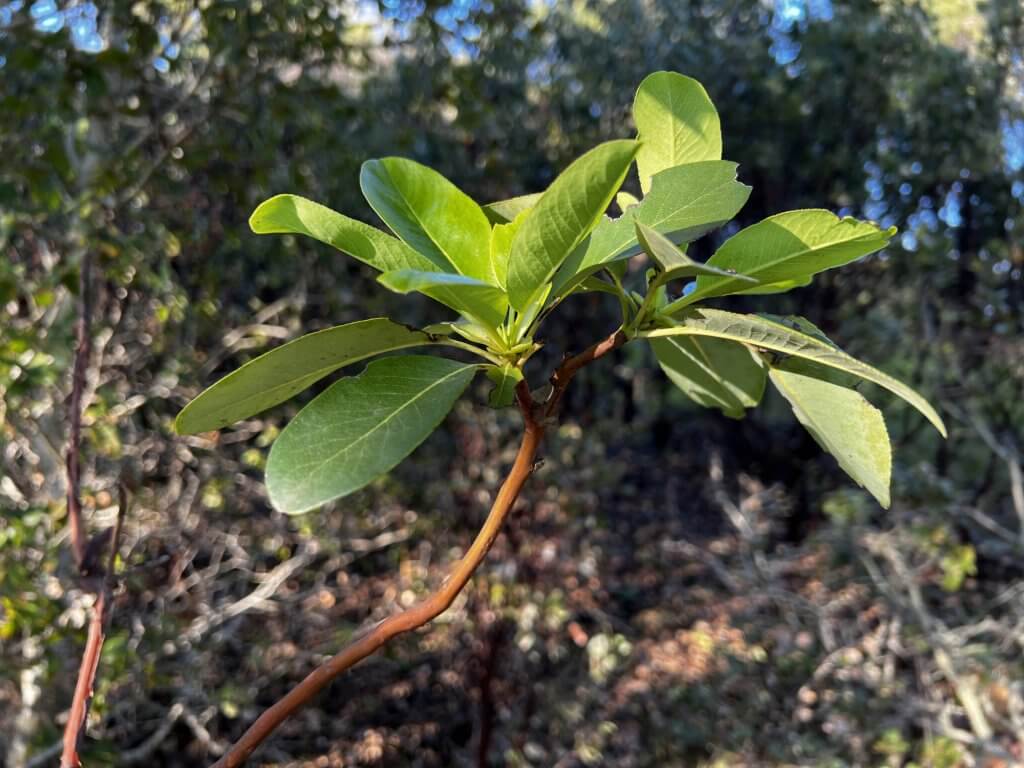
BELLS IN SPRING, BERRIES IN AUTUMN. WHAT AM I?
Answer: Pacific madrone
With twisting reddish-orange branches, large waxy leaves, and reddish-orange bark, and soaring height (some grow to 80 feet high or more), madrone trees are eye-catching trees in our coastal forests. Sprays of creamy-white, bell-shape flowers decorate madrones in spring, turning to bright red berries in fall.
Madrone bark naturally peels off in papery strips. As with the madrone’s cousin the manzanita, which you learned about on at Station 6, the naturally peeling of the tree’s bark may be a way of getting rid of parasitic organisms. These can include lichen, moss, and fungi, which tap into the tree and drain it of nutrients.
They’re nicknamed “refrigerator trees.” Touch the madrone’s smooth trunk. Notice how cool it feels? One theory suggests it’s because madrones store so much water; another says it could be because the smooth bark has more surface area than a rough-barked trunk, so it draws more heat from your hand.
Madrone berries hitch a ride. In the fall, madrone berries ripen and turn red. As they dry and fall to the ground, little hooked barbs on the berry’s surface snag on passing animals, which helps distribute the seeds.
►At the fork go down to the right to take the Bullet Hill Trail.
(Pacific madrone image: Harriot Manley)
STATION 9:
WHAT TREE BEARS BIG, FURRY FRUIT IN THE FALL?
Answer: California buckeye
With a graceful, umbrella- shape crown of thick branches, and large leaves, California buckeye trees are a handsome members of our coastal forest. Deciduous buckeyes are typically the last to grow their leaves in spring, and the first to lose them in the fall. Creamy spires of buckeye flowers attract throngs of butterflies in springtime.
The tree’s furry fruit has an unusual nickname. In the fall, buckeye bear large fruits covered with a furry skin. The outer skin eventually dries and splits, revealing the shiny, mahogany red nut within, each nut about the size of a billiard ball. Nuts resemble chestnuts, earning the buckeye the nickname of “horse chestnut.” But don’t be tempted to eat one—raw buckeye fruit contains natural toxins.
(California buckeye in winter image: Harriot Manley)
STATION 10:
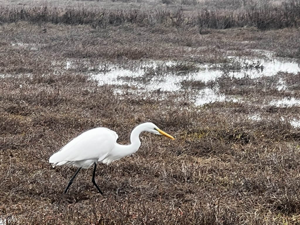
WHERE’S THE HEALTHIEST WETLAND IN THE SAN FRANCISCO BAY REGION?
Answer: Right here!
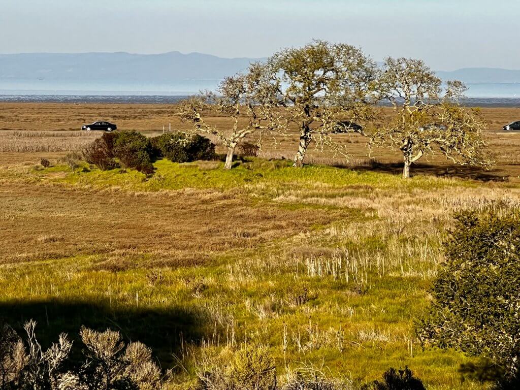
After visiting the buckeye tree, continue to wide open views of China Camp’s tidal wetlands. Scientists note that these make up some of the healthiest, most vital wetlands that remain in the San Francisco Bay region.
Why are these wetlands so special? Thousands of acres of this important ecosystem have been damaged or destroyed in the region, making China Camp’s protected wetlands even more important. They provide critical habitat for threatened and endangered species, including the salt-marsh harvest mouse and the Ridgway’s rail (formerly called the California clapper rail). Tidal wetlands also improve water quality, control erosion, and maintain stream flows. Scientists are also showing how wetlands help moderate the flow of carbon into the atmosphere, an important step in curbing global climate change.
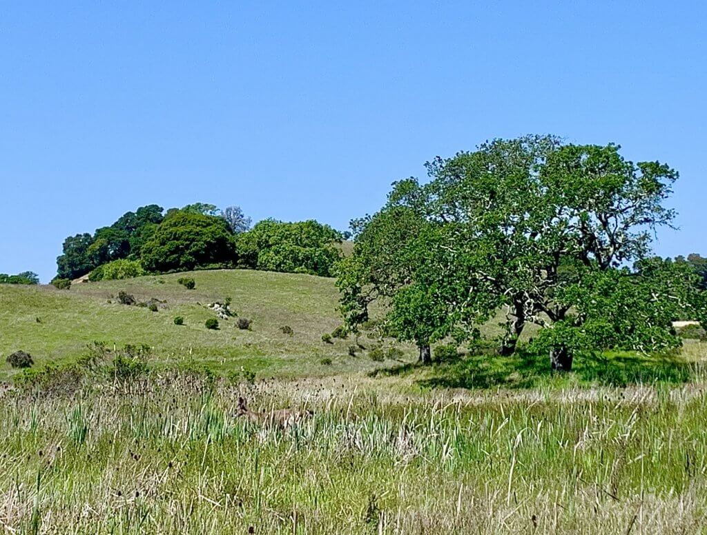
(Miwok Meadows image: Harriot Manley)
STATION 11:
WHAT HAPPENED TO THE COAST MIWOK?
Answer: A Spanish land grant took their land, and the Miwok disappeared.
Look across this beautiful meadow. Thousands of years ago, it was home to a thriving Coast Miwok settlement. The Miwok lived in villages made up of dome-shaped structures built with poles, grass, and tule reeds. Eight to 10 people lived in each hut. Larger settlements also had a sweathouse and a dance house.
The Miwok hunted and fished only for what they consumed. Coast Miwok baskets and clamshell disk beads were traded with other tribes for needed items, such as volcanic obsidian from the Southern Pomo to make sharp tools.
Explorer Sir Francis Drake called the Miwok “peaceful and loving” when he met them in 1579. The Miwok population declined after Mission San Francisco de Asís was established in nearby San Francisco in 1776. Its sister mission, San Rafael Arcangel, was built in 1817. The mission system drastically changed the traditional lifestyle of the native people. By 1900, few were left of an estimated 2,000 Miwok just a century earlier. The Coast Miwok land at Point San Pedro was eventually taken from them through a Spanish land grant called Rancho San Pedro, Santa Margarita y las Gallinas.
► Continue on Bullet Hill Trail east to N. San Pedro Rd., then turn right to walk alongside the road and back to the Miwok Meadows entrance gate.